Good day, everyone,
As we continue through this heat and humidity, we wanted to update you with the weather news for the next couple of days, especially with July 4 celebrations at hand.
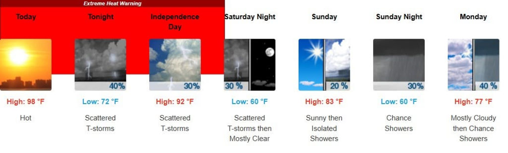
Yes, we continue to be in the Extreme Heat Warning, into Saturday night.
Key Forecast points from the National Weather Service this morning:
• Dangerous prolonged heat and humidity through Saturday, with afternoon heat indices in the 98-to-115-degree range, with little relief at night.
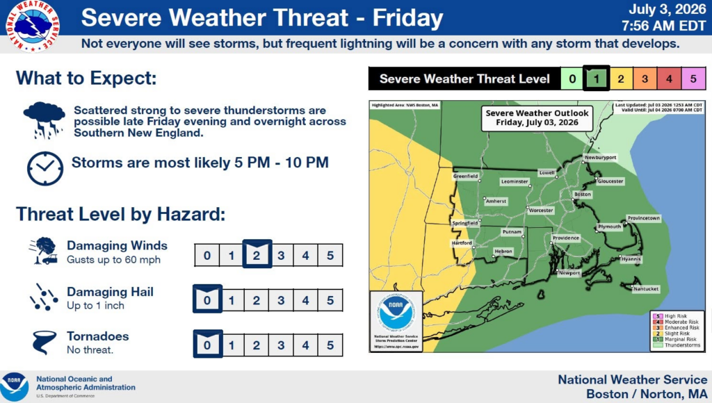
• Scattered thunderstorms this afternoon and evening, some of which may be severe.
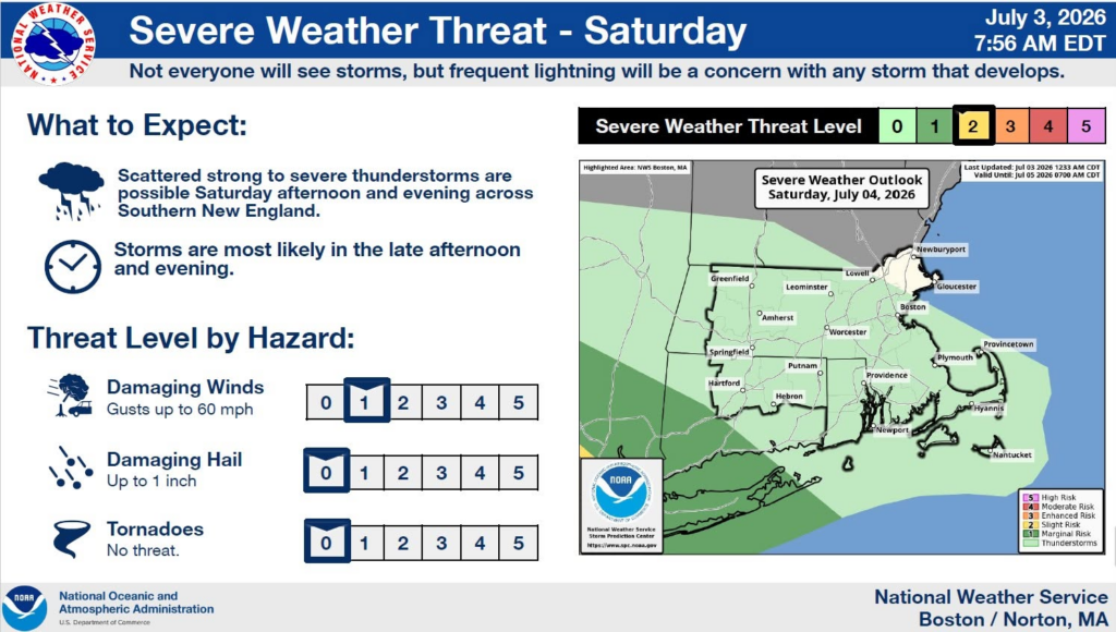
• Risk of severe weather and a few t-storms on Independence Day, but greatest risk for more widespread activity right now looks to be to our southwest. Any storms in our area on Saturday could pop up after 2:00 pm, but that is still less than a 30% chance.
• Cooler next week
The Petersham Fire Department will be hosting a pancake breakfast on the common, beginning at 8:30 am tomorrow (Saturday). The Petersham July 4th parade steps off at the common at 10:00 am. Temperature at 8:00 am in town should be in the upper 70’s, with the parade temperature remaining in the 80’s. High temperature today (Friday) could top out at 97-98 degrees. High temperature for Saturday looks to be low 90’s, and high temperature on Sunday looks to be low 80’s.
Dress appropriately for the heat, cover up, wear sunscreen, and drink plenty of water, even if you are just coming out for the few hours with us Saturday morning.
We will see some relief in the future – as Monday’s temperature looks to be in the 70’s!
As mentioned in an earlier post, if YOU or SOMEONE YOU KNOW is in need of a cooling center, please contact New Braintree Dispatch at 978-724-3232 and ask for a Petersham Police Officer to return your call or respond to your location.
Robert Laford
Assistant Emergency Manager